Brush Piles in Lake Ouachita
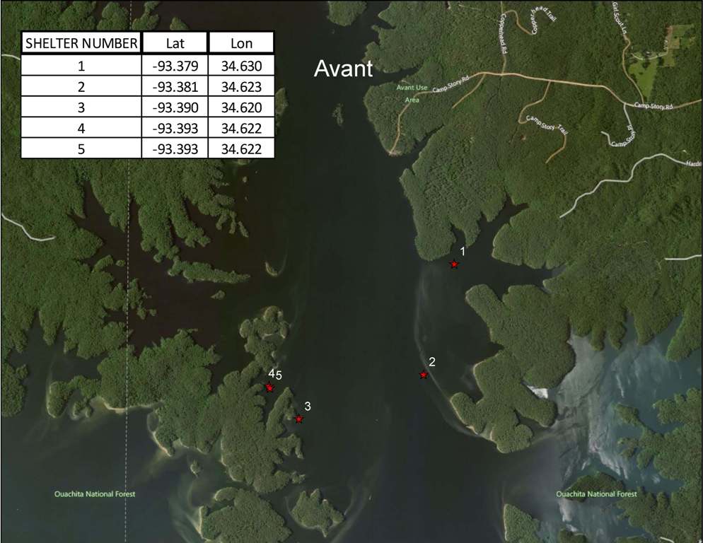
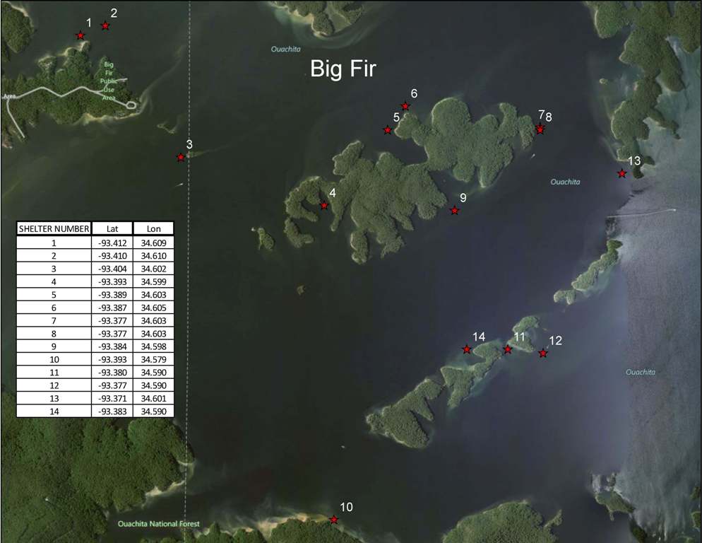
GPS locations of Brush Pile / Crappie Condos in Lake Ouachita. Arkansas Game and Fish Commission Interactive Map Showing fish attractant areas for Lake Ouachita.
Brush Piles in The Avant Area of Lake Ouachita
See The Fishing Tool Set Lake Ouachita Guides Recommend
Brush Piles in The Big Fir Area of Lake Ouachita
Tompkins Bend area AGFC fish cover locations.Signs on the bank near these sites for anglers to reference.
Site #1:
93° 28′ 10.19 W – 34° 34′ 42.96 N
Site #2:
93 27′ 54.71 W – 34 34′ 36.12 N
Site #3:
93 27′ 45.00 W – 34 34′ 31.79 N
Site #4:
93 27′ 26.28 W – 34 34′ 20.27 N
Site #5:
93 27′ 23.40 W – 34 34′ 18.48 N
Site #6:
93 27′ 25.19 W – 34 33′ 46.80 N
Site #7:
93 27′ 24.84 W – 34 33′ 43.91 N
Site #8:
93 27′ 24.11 W – 34 33′ 31.32 N
Site #9:
93 27′ 16.19 W – 34 33′ 36.00 N
Site #10:
93 27′ 06.48 W -34 33′ 47.15 N
LakeOuachita.org is a participant in the Amazon Services LLC Associates Program, an affiliate advertising program designed to provide a means for sites to earn advertising fees by advertising and linking to Amazon.com. Learn more.


